26 November 2013

The SWING Playground in St. Augustine

My awesome brother, Mike, has been trying to convince us to go to Disney World, Universal Studios or one of the other theme parks in Florida.  "You are so close right now, and it's hard for you to fly to them when you are in Hawaii."  He has offered to buy our tickets.  "Thanksgiving is the best time to go.  It's not as crowded because everyone is eating turkey, watching football, and shopping," he said.

We are so appreciative of Mike's offer and encouragement.  We loved our visit to Disney World a couple of years ago.  It was super fun because we went with Mike, my mom, my two sisters and their families.

I'm sure we would also love it if we went to one of the big parks this week, but I know it would not be as enjoyable on our own.  We would have to split up so that the older girls and the younger girls could be on age-appropriate rides.   The long lines just wouldn't be as much fun as it was last time when we had everyone else to goof around with while we waited.

"What the girls love more than anything else right now," I told my brother, "is a good playground."

We found one of the best playgrounds we have ever been to yesterday. We went to it again today, and no doubt will go play on it every day that we are in St. Augustine.  The S.W.I.N.G. in the park's name, Project SWING, stands for St. Augustine's Wish for Its Next Generation.  It is 23,000 square feet worth of extremely high quality playground that was built in 1997 by 5,000 volunteers in one week!

We love this playground.  Honestly, I think it is better than Disney World.  No lines, lots of ways for the girls (and mom and dad) to move their bodies and interact with each other (playing hide and seek, playing "marathon" -- a game where they move around the playground without touching the "alligator water," coaching each other with gymnastics, playing family, dance party, etc.), and it's all free!

PB270012


PB270011

PB260662


PB260669
Beam practice

PB260667
Sisters are the best training partners

PB260666


IMG 7541
Happiness

IMG 7542
There is a large, central pavilion with benches and picnic tables.  The pavilion provides a nice division between the playground for the older kids and the one for the younger kids. 

IMG 7543
Sage helping Skye on the monkey bars

IMG 7544
Bar practice

IMG 7546


PB290072


PB290075


PB290077
Dance party!


PB290080


PB290085
We were trying to do some syncrhonized upside down swinging

PB290089
PB290093
Phoenix loves being upside down


GETTING THERE:  The walk to the SWING Park is about 1-3/4 miles each way from the marina.  Skye walked nearly the whole way there once!  We love that the girls were so motivated to go to the park that they didn't mind the walk.  The route that we preferred to take to get to the playground was via St. George St. in Old St. Augustine.  Tons of restaurants and shops line this pedestrian-only street.  We got to know the street well and had a few favorites including the family-owned Spanish Bakery for loaves of freshly baked fluffy white bread ($2.50 for a loaf; they also have yummy empanadas and other treats) and Gerald's Gourmet Popcorn (I am so easily roped in by the free samples).   The playground is also close to St. Augustine's Visitor Center where restrooms are available.  The Visitor Center had a cool exhibit titled The New World in the Eyes of the Explorers with some drawings, paintings and maps representing "some of the most fascinating documents of this cultural collision and exchange" between the 'New World and its indigenous peoples and animals".  

THE WEATHER:  The low pressure system that has been building up in the Gulf arrived in St. Augustine today.  It was supposed to rain and thunderstorm for much of the day.  We decided we would rather go to the park and get wet than stay on the boat and remain dry.  It ended up not raining on us at all! 


IMG 7539
Rainbow popcorn. "Your popcorn matches your outfit," remarked one lady passing by Sage.
IMG 7560
The girls liked the interactive shoot-the-ships-with-cannons touch screen game at the Visitor Center. 

24 November 2013

Castillo de San Marcos: Before I Was English; Now I Am Spanish

It was a day of superlatives:

We are in St. Augustine, the oldest continuously occupied European-established settlement in the continental U.S., established in 1565 by the Spanish.  This beats Hampton, the oldest continuously occupied English-established settlement founded in 1610 and Jamestown, the oldest permanent (but not continuously occupied) English settlement, founded in 1607.  

We visited Castillo de San Marcos, the oldest stone fort in the continental U.S.

It was the windiest day of our trip so far.

IMG 7518
Today's wind on the iWindsurf.com graph for St. Augustine Beach Pier.  The blue line is the average sustained wind.  The red line marks the gusts.

Jamey says it's the first time he's been on a boat while seeing the following warning in the National Weather Service's forecast:  HAZARDOUS BOATING CONDITIONS WILL PERSIST FOR MUCH OF UPCOMING WEEK.

It was the coldest we've felt so far.  Though it was not the lowest temperature in degrees that we've had on this trip, the wind chill from the 30+ mph gusts that blew on us while we were standing on the fort by the water made it feel like it was.

Phoenix made a statement that I consider the best indicator so far that she is learning and appreciating the history that we have been relentlessly throwing her way: "Before I was English; now I am Spanish."

She was reading one of the placards in the fort that discussed how the Spanish were bombarded in 1740 by British troops who were based in Fort Frederica in Georgia.  We had spent much of last week anchored by Fort Frederica and had learned about that fort's founder, General Oglethorpe, and about his unsuccessful attack on St. Augustine.

"Last week I wanted the British to win; now I want the Spanish to win," said Phoenix.

Imagine if a change in location could alter someone's allegiance that easily.   Might there be less wars and more peace in the world?
_____________

Before we left for the fort, we visited the Teacher's Guide for the fort, accessed here under Curriculum Materials in the For Teachers section on the NPS website.  The girls and I reviewed the guide's brilliant diagrams and used them to discuss the fort's strengths.  We especially liked the cross-section of the fort found on page 4 of the Teacher's Guide.  Using the cross-section diagram, we were able to look at what would happen if you were a soldier trying to get into the fort.   We figured that a soldier would have to run up the glacis (hill), avoid musket fire from the covered deck, dodge cannonballs from the gun deck, cross two moats, and scale a very tall and steep wall.   We looked at the fort's bastions and marveled at how it seemed impossible to avoid crossfire from soldiers positioned along the many angles provided by these diamond-shaped corners.

PB240603
This picture shows one of the fort's bastions in the upper left corner.  The moat was kept dry.  During battles when the townspeople hid out in the fort, the domestic animals were kept in the moat.  It could also be filled with sea water via flood gates in the seawall.


PB240576
The fort's success in withstanding numerous attacks and bombardments is attributed to coquina, the stone of which the fort's walls are made.  Coquina is a rare limestone found on Florida's barrier islands that is made of tiny shells compressed together over time into a soft but solid stone.  Coquina was perfect for the cannon warfare of the time as it was so soft that cannonballs would bounce off the walls or be absorbed by the walls without shattering or cracking the walls.  "The British described it as a knife through cheese," explained the park ranger.  It also helped that the walls were built 12 to 19 feet thick.  "So if the wall did get damaged six inches by cannonballs, there was still 18 and a half more feet of protection!" the park ranger continued.  There were nine wooden forts in St. Augustine prior to Castillo de San Marcos, none of which lasted very long either burning, being washed away in storms or rotting.  Nine! I guess with the Spanish Crown as your insurance company, it was ok that it took ten tries before they got it right.


PB240610
We had read how the second drawbridge (far right in the picture) was the fort's most vulnerable point as it took 15 minutes to close with five soldiers operating a windlass.  Indigo had been expecting a much longer bridge and looked at the length of the drawbridge.  "I could cross that in just a few seconds," she said.  I watched her smile as she imagined dodging cannonballs, jumping onto the drawbridge while it was being raised, and running into the fort.  That's Indigo, my no-fort-can-keep-me-out daughter!


PB240597
During one of the fort's sieges, 1500 townspeople and soldiers lived in the fort for two months.  I would not want to be in charge of sanitation during a siege.


PB240572
Spanish cannons are beautiful. 

PB240567
Historic Weapons Demonstrations are held on Fridays, Saturdays and Sundays. The soldiers spoke in Spanish throughout this reenactment. 


PB240585
 Relaxing after a hard day at war.

PB240589

PB240586
The girls' favorite part of the fort was a secret room, accessible only via a narrow tunnel (only Skye could walk through, the rest of us had to crawl).  The room was sealed up and not discovered until 1832 when a cannon fell through the deck above.


PB240616

PB240611
We could have gotten a mooring ball by the fort for $20/night, but watching the boats out there rolling and pitching around made us super happy that we did not.
 
PB240583

INDIGO'S REPORT:

The fort is so that the British cannot attack the village.  All the village people go to Fort Castillo de San Marcos when the British attack. The Spanish created it for all the soldiers to live in the fort.  It was created in Florida.  The fort is a square with four corners sticking out.  Those are the watchtowers.  The Spanish started building it in 1565 and finished in 1665.

The Spanish did a few other wood forts before they did the stone fort.  The British burned down the wood forts so finally they built a stone wall.  The type of stone they used was rare.  But the stone was special because when a cannon hit it, it did not crumble.  The stone was called coquina.  It worked really well.

I loved Fort Castillo de San Marcos because it had a ton of storage space, plenty of sleeping space and sixty cannons.  They also had a cannon heating oven which was really cool.

The End
___________

CASTILLO DE SAN MARCOS:  The fort is a national monument run by the National Park Service.  It is open every day except Christmas day from 8:45 am to 5:15 pm.  Admission is $7 for those aged 16 and above, good for 7 days.  <16 year olds are free. Our National Parks Annual Pass got us in.  Aside from the curriculum materials I mention above, the Castillo de San Marcos website also has other great material including The Building of Castillo de San Marcos, a standards-based section with reading, writing and math activities designed for 4th-5th graders -- perfect for Phoenix!

PB240601


23 November 2013

Seeking Shelter in St. Augustine: Reflections on Typhoon Haiyan

We arrived this afternoon at River's Edge Marina in St. Augustine.  The weather was warm and gorgeous, apparently a typical pre-cold front day, and the trip down was uneventful.

Jamey and I carefully avoided discussing the fears we both knew we had as we moved down:

1. Was the repair that Jamey did on the squeaking engine last night adequate?
2. What if it wasn't or what if something else happened to the engine?
3. What would we do if we ended up somewhere unsheltered in the forecasted gale force winds?

The cold front that is arriving in the early morning hours tomorrow will be bringing Big Wind.  Winds will average 28 or 29, and gusts will be in the 30s and maybe low 40s.   It will be this windy throughout the entire day.  This magnitude of wind causes rough water conditions which lead to unpleasant rocking and pitching of the boat.  A few hardy folk will opt to continue to travel, but we are respectful of what I call a "domino effect that leads to doom" if anything were to happen to your engine or boat in this type of weather.   We are dutifully fearful and are so relieved that we made it to the marina.

Gusts measuring 235 mph (among the highest ever recorded) hit the Philippines during Typhoon Haiyan two weeks ago; the storm had sustained winds of 160 to 196 mph.  Storm surges between 13 to 19 feet hit various parts of the coast.

The girls are aware that we made deliberate efforts to seek shelter from the upcoming bad weather.  They understand that it makes sense to escape a storm.  They hear stories about Katrina every time we visit New Orleans.  We have had to briefly evacuate our home twice during tsunami warnings in Hawaii.

"Why did the people in the towns not evacuate?" asked Indigo as we discussed Typhoon Haiyan.

It's such a simple question.  It makes sense to a seven-year-old that you should be able to just get away from the storm.  How do I explain to her all the reasons why the typhoon's victims were still in the path of the storm?

People so poor that they do not have the means to get very far. People so poor that they do not want to leave their homes out of fear that if they are not there to protect their few possessions from the storm or from looters, they will lose everything.

Inadequate evacuation shelters, insufficient emergency preparation by the Philippine government.

Limited access to information. Limited understanding.  We have three to four great weather resources on the web that we compare and analyze to understand how severe a cold front or storm will be.  If we don't comprehend a particular forecast, we look up the terminology or look up another explanation till it all makes sense.   It seems that many of the inhabitants in the coastal towns of the Philippines may not have evacuated because they did not understand what "storm surge" meant and were not aware of how devastating and powerful these walls of water can be.

At River's Edge Marina, we are super protected from the upcoming foul weather.  It is actually warm and cosy tonight.  We feel lucky.

Our hearts go out to those who could not so easily find shelter and who were so horrendously affected by Typhoon Haiyan.
____________

Indigo and Phoenix were directed to do a little research on Typhoon Haiyan and write about the typhoon: 

TYPHOON by Indigo

On November 8 in the Philippines there was a typhoon.  It affected 11,800,000 people.  That is soooo many people.

All of the kids had to look at the dead people.  It looked so horrible! So many families were killed.  Kids lost their moms and dads.

It flooded the whole town.  All the kids were so sad.  Everybody evacuated early into a gym.  All the poor people did not have cars so they could not go to the gym.

Photo 3

TYPHOON HAIYAN by Phoenix

On November 8, 2013 in the Philippines, Typhoon Haiyan was making records.  Typhoon Haiyan is the strongest tropical cyclone ever to make landfall.  Winds at 195 mph (breaking the record of 190 mph), gusting up to 235 mph.  The sea was rising 13 feet above normal sea level.

The population in the Philippines was 98,000,000.  13% of the population in the Philippines was affected.  That's 12,900,000.

Typhoon Haiyan has left 4,460 dead, 1,900,000 homeless, 2,500,000 hungry, 12,000 babies will be born in typhoon affected areas this month.

Typhoon Haiyan caused a lot of flooding.  Rescue teams' top priorities are clean water, food, makeshift shelter and sanitation.

Source: http://reliefweb.int/report/philippines/quick-facts-what-you-need-know-about-super-typhoon-haiyan accessed 11/16/13
____________

WHERE WE ARE:  Docked at River's Edge Marina in St. Augustine, Mile 780

WHERE WE STARTED: Anchored in Fort George River, Mile 735

THERE TO HERE:  45 miles, around 7.5 hours, Jamey at the helm

PB230532
Snaking up the river to get tucked away from the winds

PB230531
Ready with the dock lines

ST. AUGUSTINE'S NIGHT OF ILLUMINATION: As per our normal modus operandi, we knew very little about St. Augustine when we arrived and certainly did not know that we were arriving on the night that marks the beginning of St. Augustine's famous Nights of Lights.  The Nights of Lights is the city's special celebration that involves lighting up the historic downtown district with two million lights for two months.  It is based on the Spanish tradition of homes and businesses leaving a candle or lamp lit during the Christmas season.  Today was the first day of this celebration, the Night of Illumination.  As we walked into town, we ran into a group of children and teens giving a dance performance.   How lucky to arrive on this special day.  We ended up close to the Christmas tree and right in the heart of the Plaza de la Constitucion during the official turning on of the lights for the Nights of Lights.

PB230537
Flagler College

PB230554
We have not been around this many people since we passed through New York City a couple of months ago. 

PB230552
A few seconds before this picture, all the lights were off. 

22 November 2013

Regretfully Leaving Cumberland Island

We are ruled by the weather that is forecast for the coming week.

The National Weather Service marine forecast for the area:

A STRONG COLD FRONT WILL MOVE ACROSS THE COASTAL WATERS ACCOMPANIED BY AN ABRUPT INCREASE IN WIND SPEED EXPECTED….STRONG NORTH TO NORTHEAST WINDS WILL CREATE BUILDING SEAS ON SUNDAY AND SUNDAY NIGHT.  A LOW PRESSURE SYSTEM WILL THEN DEVELOP IN THE NORTHERN GULF OF MEXICO ON TUESDAY...

The factors under consideration for us:

1. Big bad weather in a double whammy -- first a major cold front and then a low pressure storm coming from the Gulf.  We need to find a super protected place and definitely be there before the front and its monstrous winds hit.  
 
2. We are running low on food.  We last provisioned around ten days ago.  We even opened one of our Meals Ready to Eat the other day. (We have a box of MREs given to us from my family in New Orleans who had obtained it during one of their hurricane evacuations).  The danger of actually totally running out of food is still maybe a week away, but variety in our meals, already minimal, is fast diminishing.  Sage, who has become a picky eater on this trip, will soon have nothing she finds palatable left.

3. Thanksgiving is in six days.  Having failed at giving the girls a proper Halloween (though we were successful with our alternative version), we are motivated to find a decent Thanksgiving gathering for them.  There are a couple of these gatherings for boaters that we have heard about, big potlucks hosted by local resident cruisers that help make this holiday the social, festive feast that it should be.  St. Mary's is one of these places and is close by.  Alas, it only has a fair anchorage and because of the Thanksgiving potluck, we are not able to find marina space.

St. Augustine's is our next best bet.  It has Protection (available marina space), Provisioning (grocery stores and a West Marine), and a Party (St. Augustine Cruisers Net Thanksgiving Potluck Dinner).

Jamey is stressed.  It is always better to be where you need to be way ahead of a storm.  I know he is right, but I eke out permission for us to visit Cumberland Island National Seashore for an hour or two.

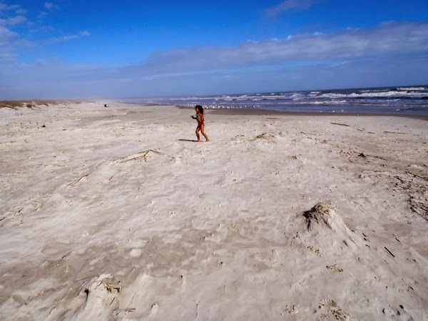
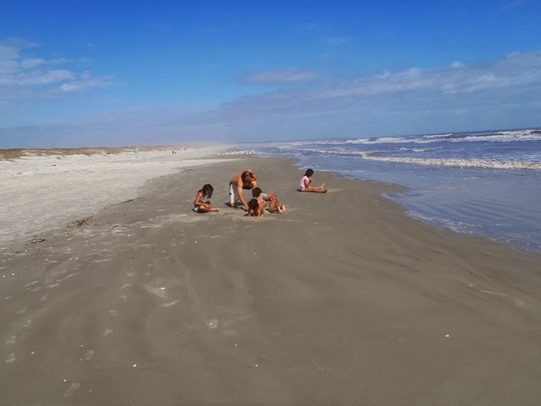
It is beautiful.  We skip on the trails, do cartwheels on the beach, dig in the sand, and jump in the waves.  The brief respite we had on this amazing protected island relaxes us (except maybe Jamey), and everyone is in a good mood for the rest of the day (Ok, except for Jamey and the engine that started squeaking loudly shortly before we anchored).

PB220431
The girls have gotten good at preparing dock lines.

PB220429

PB220435
Cumberland Island National Seashore Visitor Center
PB220438 
PB220443

PB220448

PB220449

PB220452
Not enough time to enjoy the abundant wildlife on the island, but we did see this.  

PB220453

PB220446
What a perfect place for a ranger talk.

PB220455
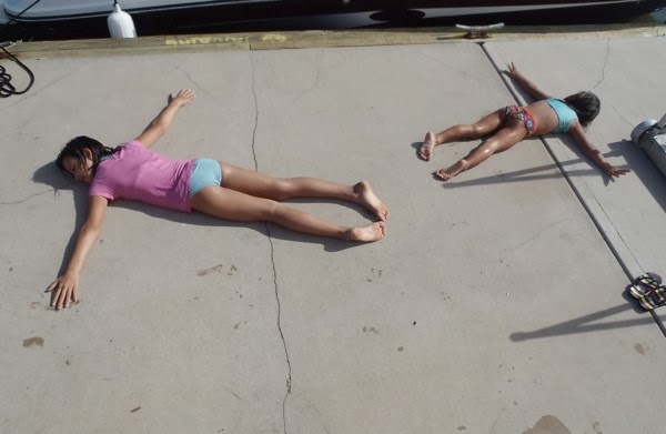
Enjoying the warm, floating, cement dock.
PB220436

____________

WHERE WE ARE:  Anchored in Fort George River, Mile 735.   Great birding with lots of egrets around and a great blue heron keeping us company.   If we had had more time, we could have rowed to Kingsley Plantation Park close by.  The plantation is part of the Timucuan Ecological and Historic Preserve, run by the National Park Service.  Zephaniah Kingsley was a planter who owned Fort George Island in the early 1800s.  His wife was an African slave who he bought.  After her manumission (act of a slave being freed by the owner), she acquired her own land and slaves.

PB220503
Skye birdwatching.  She only recently started holding the binoculars (which she pronounces 'beeeenoculars') facing the correct way. 

PB220501
The great blue heron was so close to us that I think Skye really was looking at it through the binoculars. Whenever we see birds, she will go get the bird identification book.  I think I'm breeding a birder!

WHERE WE STARTED: Anchored in Brickhill River, Mile 704

THERE TO HERE:  31 miles plus a little detour to go to the south dock at Cumberland, Jamey at the helm.  Lots to see along the way.

PB220418
Submarine dry docks

PB220423

Fort Clinch, built after the Seminole Wars (fought between the U.S. and Native Americans) and important during the Civil War. 
PB220457
Sage innocently said, "I see some castles way over there."

PB230508
 PB220464
PB220466
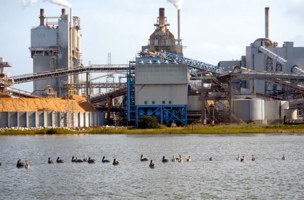
The paper mill at Fernandina Beach provides a lot of jobs. 

PB220472


CUMBERLAND ISLAND NATIONAL SEASHORE:  The park has lots of trails, historic sites, cultural ruins, a museum, campsites, ranger talks, etc.  Other boaters told us about seeing feral horses, armadillos and other wildlife.  There is also an area where you can hunt for shark teeth and have a pretty good chance of finding one.   The park is accessible only by boat.  Visitation is limited and requires reservations for the ferry and for camping.  Admission is $4 for adults (15 years+) with additional fees for camping.  Our National Parks Annual Pass got us in.  There are two docks available for transient day docking.    From the visitor center at the southern end of the park, you can access trails all over the island.  It was about a half mile walk from the dock to the beach.