07 December 2013

Boca Raton: The Yamato Colony and a Temporary Leave from the Boat

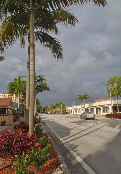
Boca Raton is a wealthy town.  This was obvious to Phoenix and me as we walked along one of the town's main streets this morning.  Fancy shops, gold-colored fountains, perfectly manicured everything.  A bit of palm tree charm offsetting an overly clean street.

PC070564

The town is relatively young, first settled in 1895.  It had a slow start, and in 1900 there were still only "six white families."

An interesting and unexpected part of Boca Raton's early history is the Yamato Colony.  This was a small Japanese community that was started in 1904 by a Japanese man named Jo Sakai who had recently graduated from New York University.  It is speculated that either Sakai saw an advertisement enticing settlers to the area ("No better location for pineapple culture in the state….In sight of the Ocean, 40 minutes by rail from the big hotels with their electric lights…") or that he was invited to start up the colony by the Model Land Company who very much wanted to increase its revenue from land sales and encourage use of its associate Florida East Coast Railway.

Whatever the reason, Jo Sakai started the colony and worked to bring Japanese immigrants to Boca Raton to buy land, clear it, and plant pineapple.  The Boca Raton Historical Society has an impressive amount of letters, telegrams, personal accounts and articles describing the colony's development and progress and the efforts made by Sakai.  We learn that Sakai had the colonists pretend to be students wanting to study in the U.S. when applying for entry, that there were difficulties during the Russo-Japanese War and that settlers endured much anti-Japanese sentiment during both World Wars.

The colony ultimately failed, unable to compete with the Cuban pineapple industry which at the time had a hefty hold on the northern U.S. pineapple market.  Nonetheless, the colony was able to leave somewhat of a legacy as one of its settlers, George Morikami, amassed a great amount of land, became a millionaire, lived a hermit-like life on a trailer on his land and towards the end of his life, donated his land to Palm Beach County.  This land is now Morikami Park and hosts the Morikami Museum and Japanese Gardens.

Jo Sakai's efforts remind me of the powerful influence that one man can have in starting an enclave of immigrants in an incongruous location.

In Hawaii, I work with many Marshallese, a group of migrants from the Marshall Islands allowed to live and work in the U.S without visa restrictions under what is called the Compact of Free Association.  I could waffle on about the difficult plight that many Marshallese find themselves in here in the U.S, but will try to not digress.   The connection I make with the Yamato Colony is that the second largest Marshallese population in the U.S. (Hawaii has the largest) is in Springdale, Arkansas because of one man.

John Moody was a Marshallese graduate of a college in Oklahoma and started the migration of Marshallese to Arkansas in the 1980s after finding a job in Springdale, marrying local, and sending word back home about the job opportunities in Arkansas.  Since then, employment offered by Northern Arkansas's multiple poultry plants and the low cost of living there have continued to draw Marshallese migrants who are now estimated to number over 6,000. 

I wish I could entice all my family and friends to join me in Hawaii.  
___________

WHERE WE ARE:  New Orleans and Bakers Inlet, North Miami, ICW mile 1079.7.

WHERE WE STARTED:  Anchored in Pineapple Lagoon, Mile 1042
___________

THERE TO HERE: 
40 miles, 8 hours 

BY NANCY:

Jamey and Sage are due in Hawaii for Sage's kindergarten interview next week.  We have been slowly piecing together logistics for their trip:

1. Where should Jamey and Sage fly out of?  A normally straightforward question is more difficult to answer when you are traveling by boat.  With the uncertainties thrust on us by weather delays and potential engine issues, we cannot know for sure where we will be more than two or three days ahead.   We decided on Fort Lauderdale when we booked their tickets last month and figured that a rental car could make up whatever distance is needed.

2. What should the rest of the family do?  Drive to New Orleans and visit my family -- yay!  If we leave a few days before Jamey and Sage, we will be able to visit with cousins who are there for the weekend, visiting from Tennessee.

3. What should we do with the boat?  We asked Jamey's parents if they might want to use their boat while we are away.  They replied enthusiastically, "Why wouldn't we?"  While we are away, Janet and Gary will sail around on C.Spirit for part of the time and will leave her moored the rest of the time down in the Miami area.  They will arrive tomorrow night and spend a day and a half with Jamey and Sage.

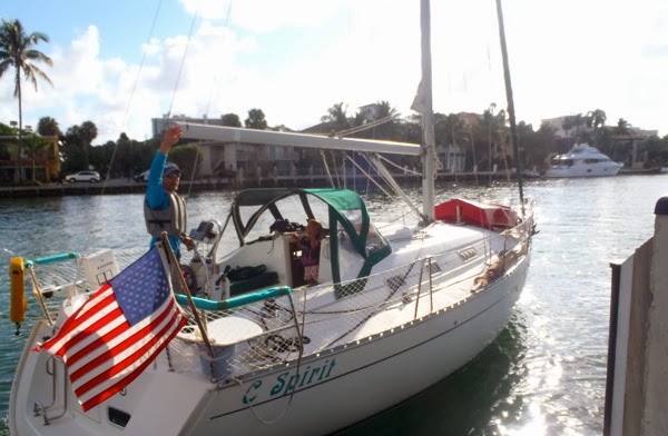
4. Rental car.  Have one delivered? Take a taxi or bus to pick it up?  We find the best option:  Budget has an office in Boca Raton located one mile from a public dock.  It is an easy tie up to the dock, a short walk to pick up the car, and it is totally stress-free loading up the car and sending Jamey and Sage back off down the ICW.

PC070566
The Palmetto Park Bridge and the dock at Silver Palm Park, Mile 1047.  Very strong current; luckily there was a flood tide and ample depth. 


PC070577
It was sad for me to say goodbye.  Sage is super excited to be an only child for a week.


PC070581
We are used to being UNDER the bridge. 

The rest of the day for Phoenix, Indigo, Skye and me is fourteen hours of driving.  We pass speedily by many small towns and through a couple of larger cities.  I feel a bit of culture shock traveling the 800 miles from Boca Raton to New Orleans so quickly when it has taken us three entire months to travel around 1,500 miles from Massachusetts to Florida on C.Spirit.   Driving is so different from traveling on the boat where our sluggish pace forces a connection from us to each town or locale.  And if not a connection, at least an opinion or observation.

BY JAMEY:

Jamey promises to post his version of the day soon. (OK here it is).

BYE BYE GIRLS

Most of the girls left the boat this morning. They are headed to New Orleans by rental car to visit family for the holidays, while Sage and I continue on south for Miami. We had planned to anchor in Lake Boca Raton and then take the dinghy across the ICW channel to the boat ramp about 1/2 mile away. We left early at first light so the girls' 14 hour car ride would not go too late into the night and arrived at the drawbridge right next to the boat ramp around 8 am.  There was a strong current flowing through the bridge, oddly carrying dozens of coconuts and other debris, which I assume was cast adrift by lazy landscapers tending the ridiculously lush properties lining both sides ofthe canal. 

As we passed through the open bridge, our targeted public boat ramp appeared immediately on the right.   We passed quickly but noticed that there was plenty of room at the adjacent public dock. Approaching this dock would mean heading downcurrent straight back at the now closed drawbridge, then making an abrupt u-turn at the very last minute and coasting into the dock. We radioed the bridge tender to let him know our plan and to check if he knew how deep the water was alongside the dock.  All cleared, we tied up uneventfully, happy to avoid the time consuming chore of anchoring the boat then launching the dinghy and rowing back and forth to the ramp with luggage and a full crew. After about 45 minutes, Nancy arrived back at the dock in the rental car, and we packed up and said our farewells.  

Back on the boat, it was so much more quiet and empty.  On my first trip below decks, I was surprised to notice a whole different acoustic quality.  With less stuff and fewer people, there was a noticable echo in the boat.  Funny how all those things that drive me crazy, like the constant chaotic noise of girls (playing fighting negotiating crying whining singing screaming), the incessant clutter of shuffled things (clothes books toys towels sleeping bags crayons maps) and the hourly spillage (milk cheerios pasta juice crumbs salsa sunscreen) become so normal that life seems empty without them. This must be a sneak preview of what empty-nesters feel when their kids leave for college, gulp!

Sage and I spent the rest of the day motoring down the ICW. We made 40 miles, seeming to find our rhythm in timing the frequent draw bridges, anchoring twice when we did have to wait and using that downtime to eat lunch and hang out together.

The end of the day was tricky.  We got fuel at Baker's Haulover in North Miami and wanted to drop the hook in a well reviewed cove about 1/2 mile off the ICW right before the fuel dock.  You can see the perfect crescent beach and the small cut you have to go through just to the left of our pinned anchorage below. Being a Saturday afternoon there were dozens of powerboats anchored just off of the sandbar that Baker must have had to "haul over" long ago. I read the directions for entering the harbor and headed in. There was a Towboat US and a Seatow boat standing by for boats running aground on this extremely shallow section of the waterway.  Immediately after leaving the dredged channel, the depth was too shallow, I slowed, reversed and got back in the channel to regroup even as the towboat captain was barking at me on the radio... hmm where did I go wrong? It was getting late, I was tired, and had no good copy of the chart, so I decided to continue on south and find another spot.  Doing so meant traversing the notoriously shallow haulover, but lots of other boats were doing it, so I didn't give it a second thought.  


After crossing through the haulover by simply following the bouys and taking what seemed like a reasonable line through the channel, I started considering options for anchoring.  I couldn't be sure to find something suitable in short order, and the weather forecast was gentle, so after about 10 minutes, we turned around for the first time on the trip and headed back north. We got to re-try the shallowest stretch of the ICW in Florida!

I must have picked a slightly different line this time, because as we passed the sandbar filled with frolicking weekenders, we bumped once, twice, three times before the depth finder even showed shallow, and then we were back in deep water. On this shot through, Bakers Haulover was more like Bakers "Bumpover" for us.

We dropped the anchor about 4:30 in the midst of all the motorboats playing at the sandbar and took a short swim.  Slowly, as afternoon faded into evening, boats began pulling up anchor and leaving. The last boat left after dark at around 8:00 pm and we had this slightly open spot to ourselves for the night.  Sage and I had scrambled eggs for dinner and played dominoes for a while.  We made a few versions of the domino castle below which we could not have done with everyone on board, then went to bed around 9.

06 December 2013

Drawbridge Day

JAMEY'S POST:

From time to time we pass under a bridge.  Usually these bridges are crossing from the mainland out to the barrier islands that protect the coast.  Farther north on the Intracoastal Waterway, many older drawbridges and swing bridges have been replaced by high clearance bridges that sailboats like C. Spirit can pass under without (much) hesitation.  The newly built bridges have a standard minimum height of 65 feet.  The top of our boat's mast is 46 feet above the water, so we clear under these bridges with ease.

In South Carolina, the few remaining swing and draw bridges need frequent repair, and signs are posted next to each bridge stating that the bridges will not open if a hurricane is coming or if the wind speed is higher that twenty-five miles per hour.  Inconvenient at best, dangerous for a boater seeking shelter from a coming storm.

Some days we have passed two or three bridges, often timing our arrival with the GPS to match their opening schedule.  Some bridges open on the hour and half hour, some only on the hour, some bridges open on request (meaning just call), and some do not open during rush hours.  It is a pain to try and keep track of these restrictions, and disappointing to arrive and find that you missed the recent opening and have a fifty-five minute wait until the next.

Today, nearing the end of our trip down the east coast, we came to a section of south Florida where the priorities are shifted.  Access to the coast for everyone is paramount it seems, so older draw bridges have been replaced by newer versions of the same.  It seems the policy along parts of this stretch of the coast is that no car should have more than about a two mile drive to a bridge connecting to the coast. Happily, many of the restored or rebuilt bridges have unique architectural touches that echo the original designs, and all of these new bridges work reliably, even in high winds.

We planned to move fifty miles farther south today, starting at around 7:30 am, which usually gets us anchored around 2:30 pm. But today was different, today was A DAY OF MANY DRAWBRIDGES!! Today we passed through sixteen drawbridges!!!!

It started easily enough with two bridges that opened on request, but then we ran into a stretch that opened on the hour and half hour and were about four miles apart, just far enough that we could not make the distance between the bridges in the twenty-five minutes between clearing the first and the cut off time for the next.

So we waited, and then sprinted, only to have to wait, then we became clever and used the GPS to set a leisurely pace to arrive just in time for the next opening, only to find that the times had changed due to construction.  Near the end of the day, we were fourth in line for a bridge, and the bridge tender closed the bridge right as we came up, then said over the radio, "Sorry, I did not see you back there, I will clear the traffic and get the bridge open right back up, and he did, but we were not able to make it up to the next bridge in time, and had another twenty-five minute wait  for an opening that we missed by just two or three minutes.

In the end, we only were able to make forty miles before we stopped for the night.  Though the boat cruises at a little over seven miles per hour, we averaged only around four miles per hour today.

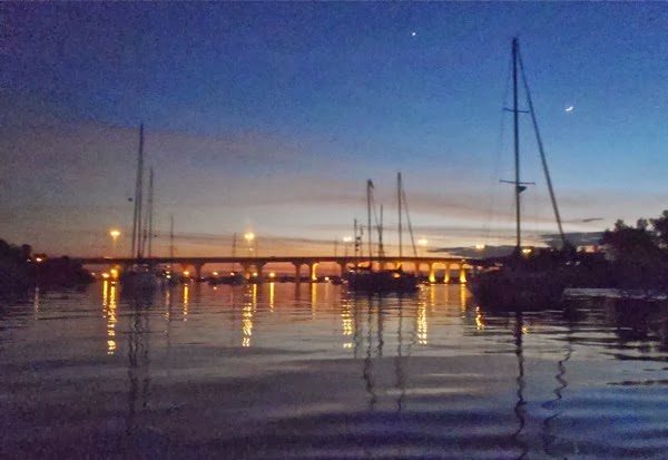
We finally anchored about twenty minutes before sunset in Pineapple Lagoon, a tiny, man-made lake just off the waterway.  We are surrounded on all sides by docks, houses and condominiums. It is very sheltered, but a strange, uniquely Florida experience to be anchored in the midst of this suburb, able to hear movies playing in living rooms and dogs barking at front doors a short way across the water.

At the end of the day, the captain was worn out, not sure if the lesson was to relax and go with the flow, or to be smarter and learn to play the tides and times to optimize travel time.

Tomorrow and the next day, traveling from Boca Raton to Miami will be more of the same.  We will try for shorter distance goals, maybe half as much, and see if that makes things any better.

PC060516


PC060518


PC060519

PC060548

PC060549

PC060550

PC060551

PC060552

PC060553

PC060560
While waiting for one bridge, we were next to a public dock and a playground.  Unfortunately, we only had 15 minutes before the bridge was due to open.  Sage gazed longingly at the playground -- such torture!!

_____________

WHERE WE ARE:  Anchored in Pineapple Lagoon, Mile 1042, Boca Raton.  Reportedly there is poor holding here, and before going to bed, I checked the rode to see how the anchor was doing.  It seemed as if we might be dragging a little, so I pulled out the Big Dog -- a brand new Danforth anchor that I bought at the start of this trip and have not yet used.  As I went to pull up the other anchor, I realized that it was set really well after all.  Big Dog has to wait for another night.  

IMG 7604
Pineapple Lagoon


WHERE WE STARTED:  Anchored in Hobe Sound, Mile 1001

THERE TO HERE: 41 miles, 16 drawbridges!  Jamey at the helm.  Indigo took most of today's photos. 

PC060509
Lots of enormous, fancy houses line the ICW here.

PC060511
There are also a lot of big, fancy boats. 

PC060510
And lots of enormous, fancy houses that have big, fancy boats. 

PC060513
It's super built-up. 

PC060522


PC060529


PC060532
Water play.

PC060515
Water TV. 

PC060537
It would be just fine with me if I never see a bridge ever again.

PC060563

05 December 2013

The 1991 Adventures of a Navy Officer: We Recognized We Were Not Really Going Anywhere

One of the great things about blogging has been the connections it has created with friends and family.   For example, we have really been enjoying the emails that our friends Sean and Michelle have been sending from Kailua, Hawaii.  Sean is one of the smartest people that we know.  He shares our passion for and addiction to windsurfing, and we appreciate that he always has a cup of coffee in his hands.
 
Sean works with submarines as a civilian contractor in Hawaii (I think).  Jamey probably understands Sean's work better than I do.  I can only describe his work as "something to do with submarines, but highly classified so he can't really tell us."

In 2010 the following announcement was made:

> SUBJ/ HERMAN DWORKIN MARITIME ANALYTIC EXCELLENCE AWARD SELECTION 2010// POC/A. EASTON/LT/N2N6C1/LOC:WASHINGTON DC/TEL:(703)695-3982// RMKS/1. REQUEST ALL ADDEES GIVE THIS MESSAGE WIDEST DISSEMINATION TO SUBORDINATE ACTIVITIES/ELEMENTS WITH INTELLIGENCE PERSONNEL ASSIGNED.

> 2. SINCE 1983, THE HERMAN DWORKIN AWARD IS PRESENTED ANNUALLY TO THE CIVILIAN OR MILITARY ANALYST WORKING MARITIME ISSUES WHO EXEMPLIFIES, THROUGH HIS/HER WORK AND ATTITUDE, MR. DWORKIN'S TRAITS OF ANALYTIC EXPERTISE, STRENGTH OF CHARACTER, INITIATIVE, INDUSTRIOUSNESS AND EXACTITUDE.

> 3. THE SELECTEE FOR 2010 IS MR. SEAN BROSSEAU OF COMMANDER SUBMARINE FORCES, U.S. PACIFIC FLEET, FOR HIS ANALYTIC CONTRIBUTIONS TO IMPROVING SUBMARINE MISSION PERFORMANCE.

> 4. THE AWARD WILL BE PRESENTED AT THE NAVAL INTELLIGENCE PROFESSIONAL'S "RED TIE" LUNCHEON SCHEDULED FOR 23 APRIL 2010 AT THE TYSON'S CROWNE PLAZA, MCLEAN, VA. MR. BROSSEAU'S NAME WILL BE INSCRIBED FOREVER ON A LARGE PLAQUE ON DISPLAY AT THE OFFICE OF NAVAL INTELLIGENCE.

Below are pictures and stories from him, taken directly from his emails.
______________
Aloha Nancy, Jamey, and all the girls !

It’s been fun reading through your blog, especially because of some ties to some of the areas you guys have travelled through.

I grew up in Havre de Grace, MD, basically where the Susquehanna River opens up and the Chesapeake Bay starts.  It seems like you guys started out in the Bay south of there. You can show the girls where HdG is ...

https://maps.google.com/maps?q=Havre+de+Grace,+MD&hl=en&ll=39.557464,-76.091652&spn=0.047513,0.132093&sll=20.46,-157.505&sspn=9.953227,16.907959&oq=havre+de+grace&t=h&hnear=Havre+de+Grace,+Harford,+Maryland&z=14

Other good tidbits...  Way back when I was in the Navy, the submarine I was on (USS ALBANY)...

(The picture below is in Gibraltar in 1992.)

Seanb5


...ended up in two of the shipyards/drydocks you guys have passed by:

1) Newport News Shipyard in Hampton area (where you saw the new aircraft carrier being built...)   This was also where my boat was built.  ALBANY had the distinction of being the last U.S. submarine to be built and launched “on the ways”...sliding backward into the river. Nowadays, they are rolled out and lowered in the river in a launch dock.

2) We also had to go into drydock at Kings Bay Submarine Base down near St. Marys Georgia for a short visit for repairs.  As you may have figured out, the “castles” the girls saw down in that neck of the woods are the paper mills in the area.  White pine grows fast...good for making paper pulp.  But smelly if you are downwind...

I also did some short sailing on the ICW down in Florida when we were attending Nuclear Power School in Orlando back in 1991.  Some charter boat company was foolish enough to rent a boat to a bunch of brand new Navy officers.  I had to really chuckle about stories about running aground and following the day markers.  Late in the afternoon, we grounded, but it was a muddy/sandy bottom and we sort of eased in without knowing, until after a while we recognized we were not really going anywhere.  Then one of the guys dives in to see what we are caught on, and the water is only up to his thighs.  The other fun thing was not making it to our planned anchorage for the night, and trying to follow day markers sitting on the bow with a Q-beam light.  We were not the “saltiest” of mariners, by any stretch :

Seanb4

Anyways, keep having fun in your adventures.  It certainly is fun to read the stories...(Pungo is a name I have not heard since we lived in Va Beach...great strawberries
in the summer...)
____________
[After finding out that we had started out in Massachusetts and had passed by Havre de Grace and because I asked him for more pictures, Sean sent the following:]
____________
Cool...you guys must have gone through the C&D Canal, and popped into the bay right across from where my dad works...Aberdeen Proving Ground.  They don’t shoot artillery out into the bay anymore, so not quite as exciting as when I was a kid.  You also went right by Elk Neck State Park, another place I have been to.

If you go back that way, you should stop in Havre de Grace.  (The British did in the War of 1812 and burned the town down.  quick history lesson for the girls...)
It’s a cool little town.   Plus, if anything is broken that you need fixed, I would volunteer my dad to help. Although I have to say, Jamey is pretty handy....I dig the repair stories.  All part of the seagoing adventure.

Here’s my dad working on the car he is restoring.  New quiz for  the girls... the name of the manufacturer of this type of car (from 1936) is the same word used to describe a large amount of cut firewood (a concept pretty foreign to Hawaii girls...)

Seanb6

There is a photographer in HdG who maintains a Facebook page called Forgotten Havre de Grace.  He posts pretty amazing shots of the river, bay, waterfront, etc.  I am sure you can appreciate them spending so much time on the Chesapeake.

The real trick with the tube behind the boat is the swap out of riders.  Note ingenious use of 2 lines...only something a boat full of engineers would come up with.  And you need to be confident in your treading water skills as it might take a while to come back and get someone who falls off. We learned quickly the swap was too hard to do holding a beer can, so refreshments were tossed after successfully getting on the tube.

Seanb7

Here are a couple more I scanned from that same sailing trip back in 1991 (we were in school in Orlando for 6 months from Mar-Aug) , including one going under a bridge, probably doing the same thing you did...looking up and wondering if you will make it.

Fair winds and following seas...

Sean, Michelle and Windy

Seanb1

Seanb2
Seanb8
Thank you for sharing with us, Sean and Michelle!!
Seanb9
I love this picture that Sean took of them playing on our bay at home. 
 _______________

WHERE WE ARE:  Anchored in Hobe Sound, Mile 1001! Another Hallelujah Moment for Jamey (first one was at Mile Zero).  Warm water, good swimming.

WHERE WE STARTED: Moored at Vero Beach City Marina, Mile 952

THERE TO HERE:  51 miles, Jamey at the helm with a little help from Nancy and Phoenix.

Jamey caught a fish by motoring along with the handline trolling behind. 

Here is a video showing one of the reasons why Sage has a ton of calluses on her hands:


04 December 2013

Vero Beach: Mastadons With A Message

Two days ago an agreement was signed allowing scientists to start an archaeological dig at Vero Beach, an excavation that is being dubbed "An Ice Age Dig."

There have already been many significant fossils found in Vero.  Many of these were unearthed during the dredging of a canal in 1913, and findings since then have included fossils from mastodons, saber tooth cats, giant sloths, mammoths and humans.

At the time of the original fossil findings a hundred years ago, the thought at the time placed humans as coming to North America no more than 6,000 years ago with theories that they walked here either across an exposed continental shelf between Alaska and Siberia or across a frozen Atlantic via Greenland.   The major significance of the Vero Beach findings was that they placed humans in coexistence with mastodons and other extinct species of the Pleistocene Epoch, much longer than 6,000 years ago.

It is now accepted that humans came to North America either by foot or by boat around 10,000 to 15,000 years ago.  There remains much controversy, however, surrounding the age of the human remains found in Vero Beach.  One of the most important finds, the bones of a human named "Vero Man" (since then found to probably be "Vero Woman"), have been lost or misplaced during the many transits the bones did between the Smithsonian and other various research institutions.

In 2009, a bone with a carving depicting what is believed to be a mastodon or mammoth was found by an amateur fossil collector.  This piece has been dated to be at least 13,000 years old and is believed to be "the oldest work of art in the Americas."

Vero Beach definitely holds more clues, stories and works of art buried deep within its beautiful, sandy expanses.  A storm water treatment facility is planned to be built over the Vero Beach site.  This recent agreement allowing the Ice Age Dig to proceed will hopefully unearth more of our amazing history before it is covered over by tons of cement.

PC060525
"Da Xiang" is our favorite mastadon and has been with us since Phoenix was a few months old.  Her message is "I love Phoenix!" Photo by Phoenix. 

PC060526
A mastodon differs from a mammoth in many ways. Mastadons are shorter and more muscular and are believed to have been in existence starting around 27 to 30 million years ago.  Mammoths arose maybe 5 million years ago.  Both became extinct around 10 to 12,000 years ago.  Both have long, curved trunks that were probably used to scrape ice and snow off plants. 

 _____________

WHERE WE STARTED:  Anchored at Rock Point, Melbourne, Mile 925

WHERE WE ARE: Moored at Vero Beach City Marina, Mile 952

PC040436


PC040439
Longest dinghy dock we've ever seen.  This shows around 1/3 the length of the dock. 

PC040440

THERE TO HERE:  27 miles, Jamey at the helm.  We stopped at Vero Beach City Marina to get some gas and water.  We have been having some trouble with the fresh water pump system, and have had to fill up the tank more often than usual.   We originally intended to travel around 50 miles today, but while getting gas were enticed by the cost of a mooring ( $13) and the proximity of the beach.   There are free shuttles that run regularly between the marina and the beach and town.   We missed the shuttle by just a few minutes, but it was only a little less than a mile to walk to the beach.

PC040435

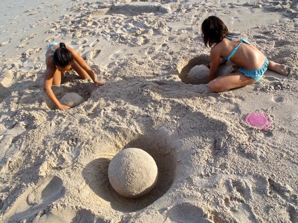
AT THE BEACH:  Art class.  Sand sculptures and a lesson on negative space.  Negative space is basically space where there isn't anything.  It's one of my favorite art concepts and a way to approach  drawing, painting, sculpting, etc.  If something looks like it should be there, put it there.  If something looks like it doesn't belong there, take it away.   Really it's a notion that can apply not just to art, but to how we live our lives.

PC040432
Crab with Accidental Foot over Face


PC040431
Dancing Dolphin


PC040430
Happy Mermaid

PC040428
Mermaid with Fingers


PC040429
Swirly Mermaid

PC040427
With credit to the girls' kindergarten and first grade art teacher, Mrs. Merritt, the girls already had studied and knew all about negative space.
PC040433
Very calming.  Even more therapeutic was when Sage stomped on all of the balls.  "Remember as Junior Rangers we are supposed to take nothing but footprints and leave nothing but memories!" she said.  We always take a lot of footprints with us when we leave a beach. 
PC040434
Frisbee on Sandball Held Up by Smurf in Negative Space